
NATIONAL PARKS · PARK 2 OF 64
Black Canyon of the Gunnison
A Field Guide
On this page
A small park with one great drive, a dark sky worth staying up for, and trout at the bottom. How to see it in a weekend, especially if it's your first time camping.
Version 1.1 · Updated Nov 17, 2026
Map
When to go
Average monthly visits, 2023–2025. Source: NPS visitor statistics. ● marks the months we visited.
| January | 10,319 |
|---|---|
| February | 7,238 |
| March | 9,502 |
| April | 11,311 |
| May | 36,019 |
| June | 54,324 |
| July | 43,330 |
| August | 40,322 |
| September | 49,489 |
| October | 34,220 |
| November | 13,196 |
| December | 5,069 |
See Black Canyon of the Gunnison on the National Parks Atlas →
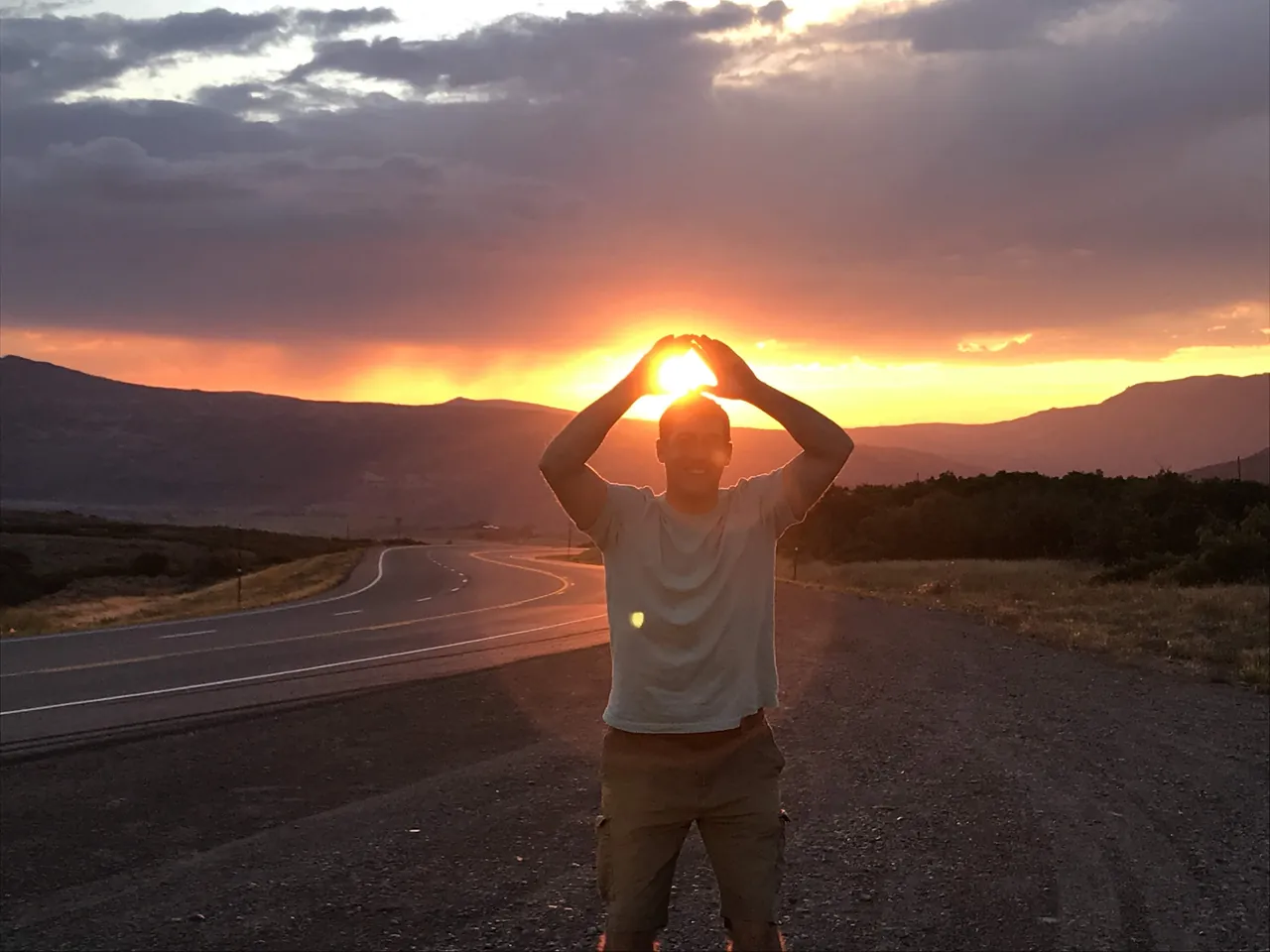
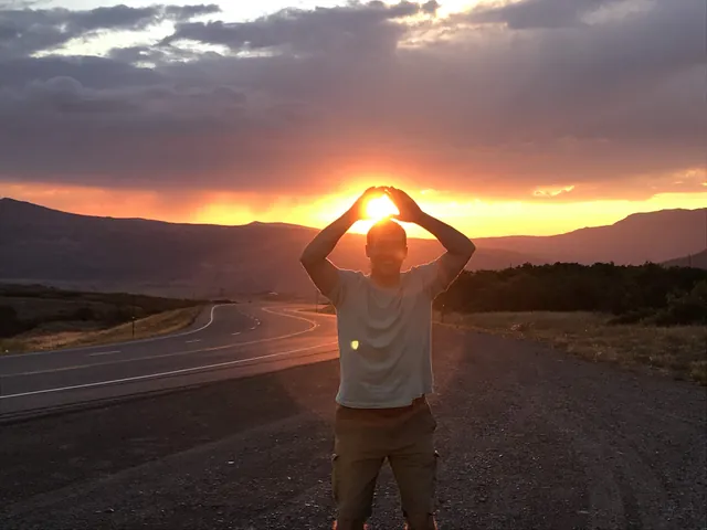
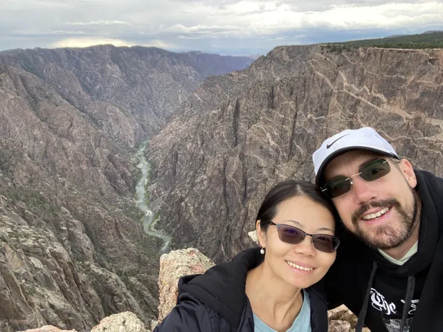
Black Canyon was our first real national park trip, the first time Carrie and I camped in a park. (Rocky Mountain came first on the calendar, but that was a day trip from home.) We drove in from Golden on a Friday in August 2018 and reached the South Rim at dusk, just as the sun went down. It was one of the best sunsets we had ever seen. We pulled over, got out, and took photos with our hands cupped around the sun so it looked like we were holding the light.
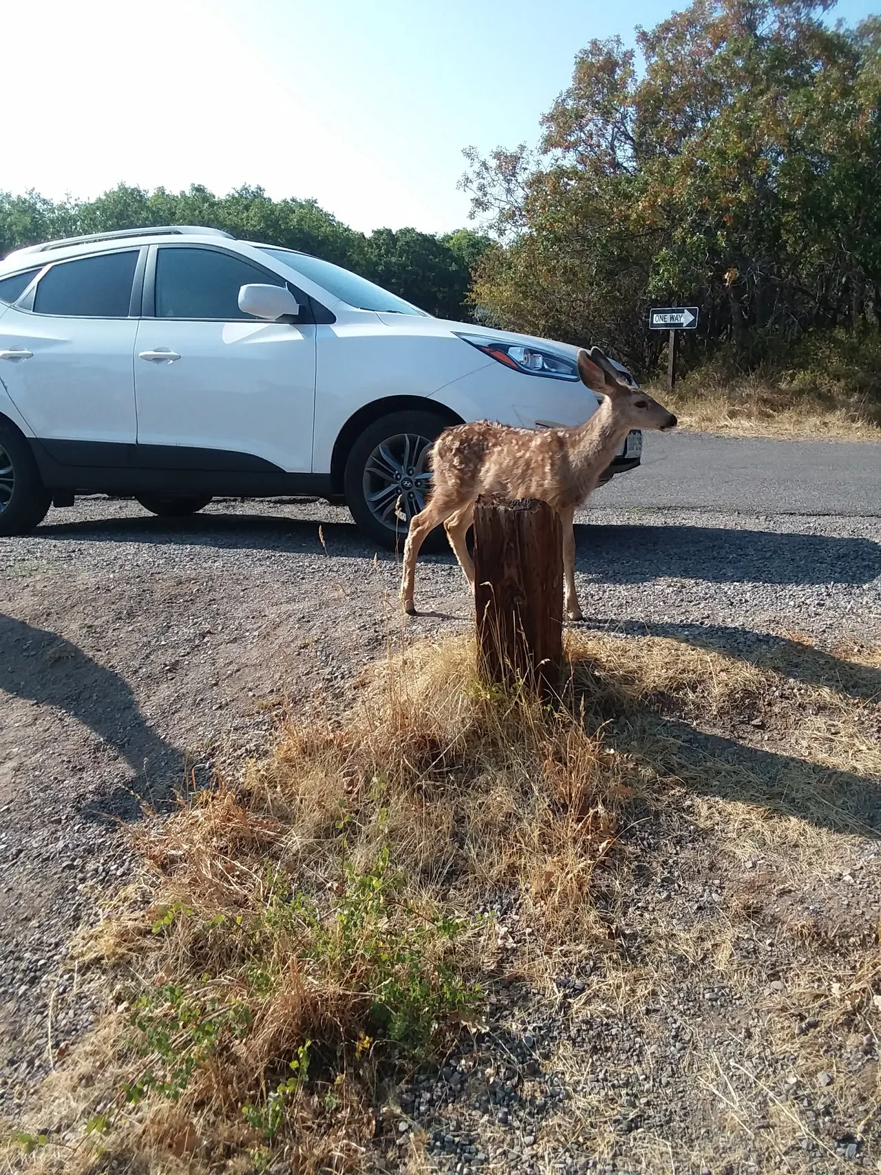
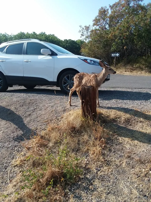
Then everything was a first. Our first national park sign. Our first campground together. Our first time pitching a tent, in the dark, with a headlamp. I barely slept: something kept moving outside all night, and we were both sure it was a bear. In the morning we found the culprits grazing next to our site. Deer.
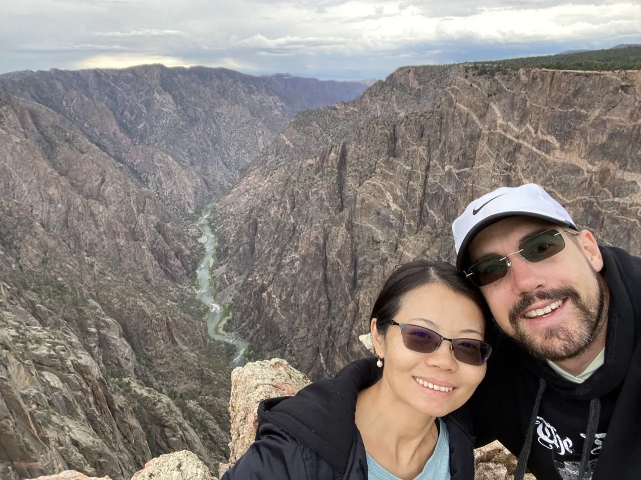
I've been back many times since, now with a fly rod. This guide is what I'd tell a friend going for the first time.
The short version
It's a small park. There's one main drive along the South Rim with about a dozen overlooks, and very little hiking on top; the serious hiking goes down into the canyon. One full day covers the rim. A night lets you add the sunset and the stars.
Go to the South Rim. The North Rim is quieter, but no bridge crosses the canyon, and driving from one rim to the other takes 2 to 3 hours. If you only have a few days, skip it.
Keep your expectations right. The views are breathtaking, but there's a limited number of them. Black Canyon is best as one stop on a longer trip through the region.
Stay up for the night sky. That alone is worth the trip.
The park at a glance
- 2,250 ft
- Height of the Painted Wall
- 40 ft
- Width at The Narrows
- 12
- Overlooks on the South Rim drive
- 2015
- Dark Sky Park since
Where: about 250 miles southwest of Denver. The South Rim is 15 miles east of Montrose via US 50 and CO 347.
How high: the rim sits around 8,000 feet. South Rim Campground is at 8,320 feet and High Point at 8,289. Drink more water than you think, wear sunscreen and take it slow.
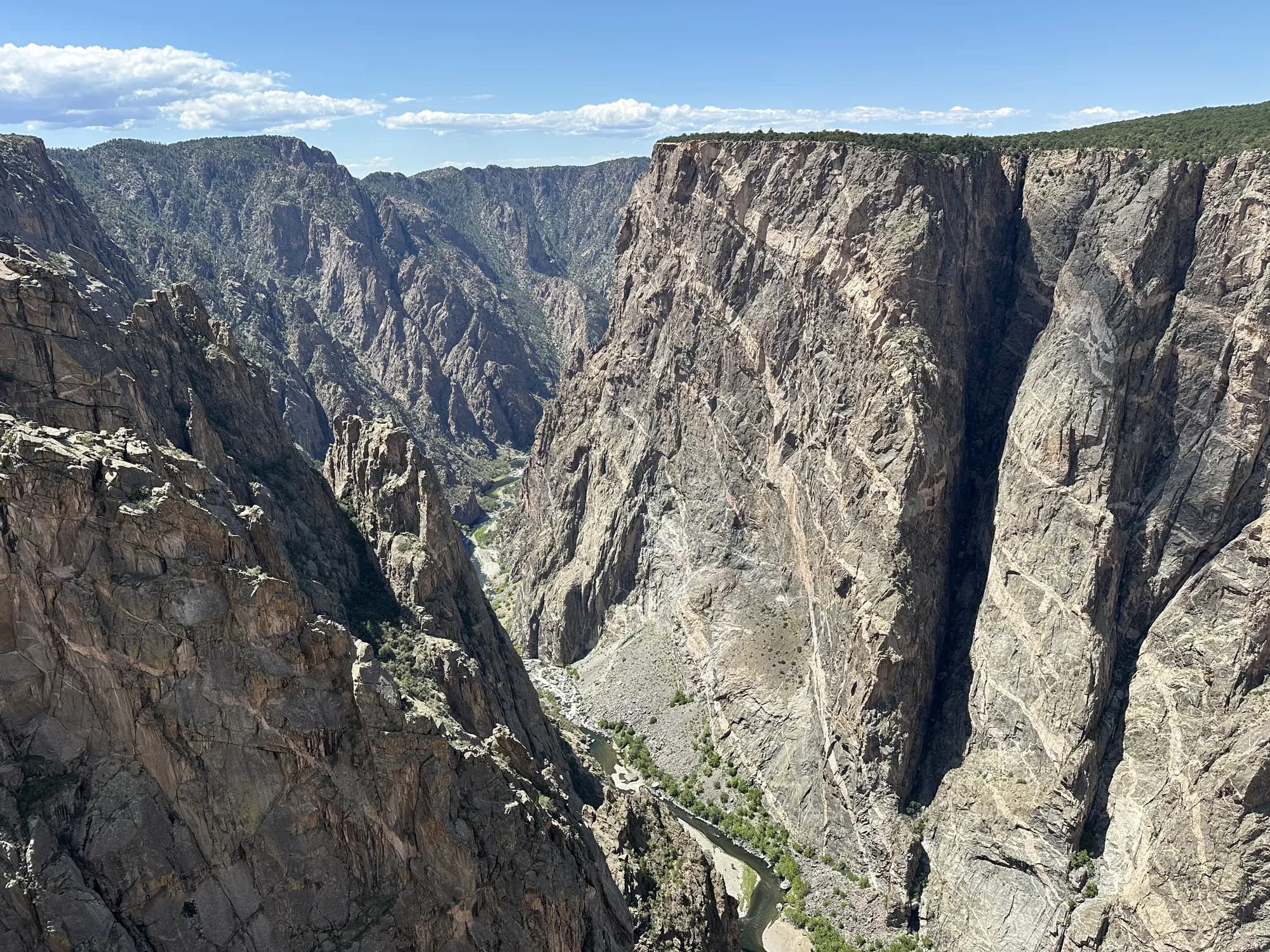
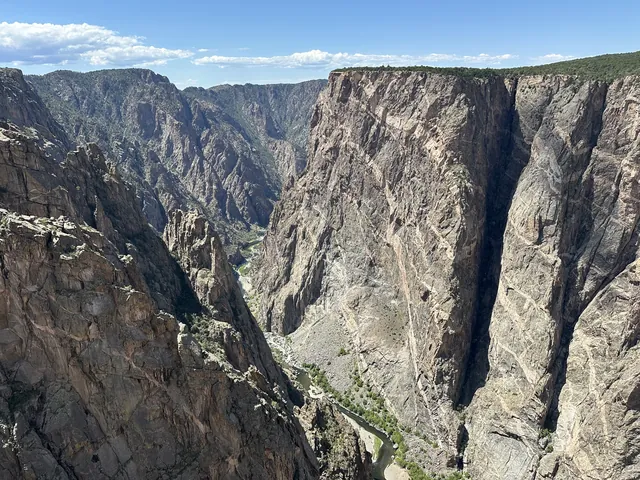
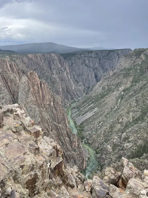
How deep and narrow: the Painted Wall rises 2,250 feet. At The Narrows the canyon is 40 feet wide at the river. At Chasm View the rims are 1,100 feet apart.
How wild: the inner canyon is designated wilderness, more than 17,000 acres protected under the 1964 Wilderness Act.
Campgrounds: two in the park. South Rim is reservation-only on Recreation.gov, and North Rim has 13 first-come sites. East Portal's small riverside campground sits just outside the park, in Curecanti National Recreation Area. Water is off at all of them in winter, and the park is cashless.
Contact: 970-641-2337 or nps.gov/blca. In an emergency, call 911.
If you go
Start at the visitor center. South Rim Visitor Center is open year-round, with shorter hours in winter and a few holiday closures. It has exhibits, rangers, wilderness permits and the Junior Ranger program, and Gunnison Point overlook is right behind it.
Check conditions before you go. In July 2025, lightning started the South Rim Fire, which burned across parts of the South Rim and down toward East Portal. The Rim Rock and Uplands trails pass through the burn. In 2026, rain on the burned slopes caused mudslides that closed East Portal Road and its campground more than once. Check the park's current conditions page before you drive down: https://www.nps.gov/blca/planyourvisit/conditions.htm
Getting there. The South Rim is about 15 miles east of Montrose. Montrose has breakfast, dinner and groceries. Use it. You don't have to treat this like an expedition; camping plus a meal in town is a perfectly good trip.
Where to sleep. We camped at South Rim Campground, inside the park on the South Rim, near the entrance. Sites are reservable on Recreation.gov and are a good size, with a picnic table, a tent pad and a fire pit. There are good bathrooms but no showers. Drinking water runs from mid-May to mid-October. Bears do live in the area, so store food as the campground asks. On our trip, though, the only wildlife in our site was deer. Firewood isn't provided and gathering it is prohibited, so bring your own and burn it only in the fire grates.
The Montrose KOA or a range of hotels are a good option if you can't reserve a campsite (they can get booked quickly). Also, if you're really in a pinch, check into the public lands just on the road into the park where you could feasibly camp in your car for the night. You could feasibly drive in for the day from Gunnison or Crested Butte as well, but that isn't ideal if you want to see the sunset and night sky.
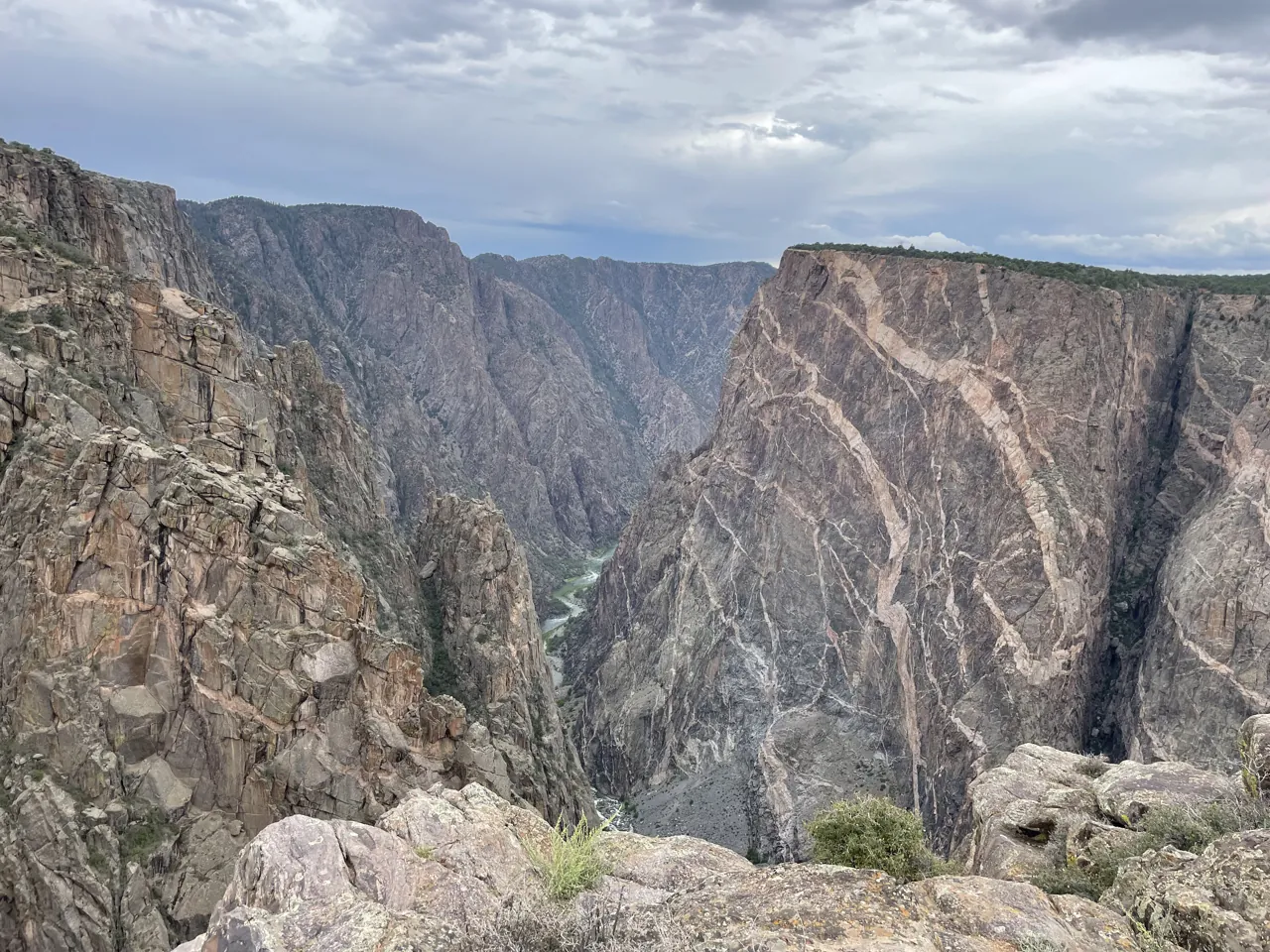
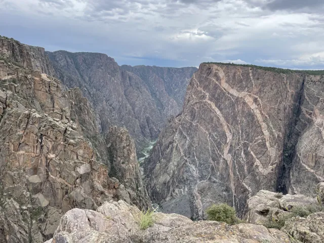
The rim drive. South Rim Road runs about 7 miles past 12 overlooks. Give it an afternoon. In order from the visitor center, the overlooks are Gunnison Point, Tomichi Point, Pulpit Rock, Cross Fissures View, Rock Point, Devils Lookout, Chasm View, Painted Wall View, Cedar Point, Dragon Point, Sunset View and High Point. The one that stopped us was the Painted Wall: at 2,250 feet, it's the tallest cliff in Colorado. See it from Painted Wall View and again from Cedar Point. Finish at Sunset View for sunset.
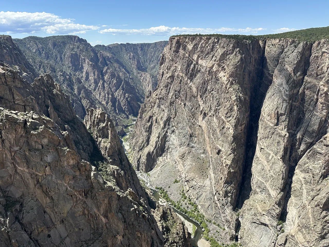
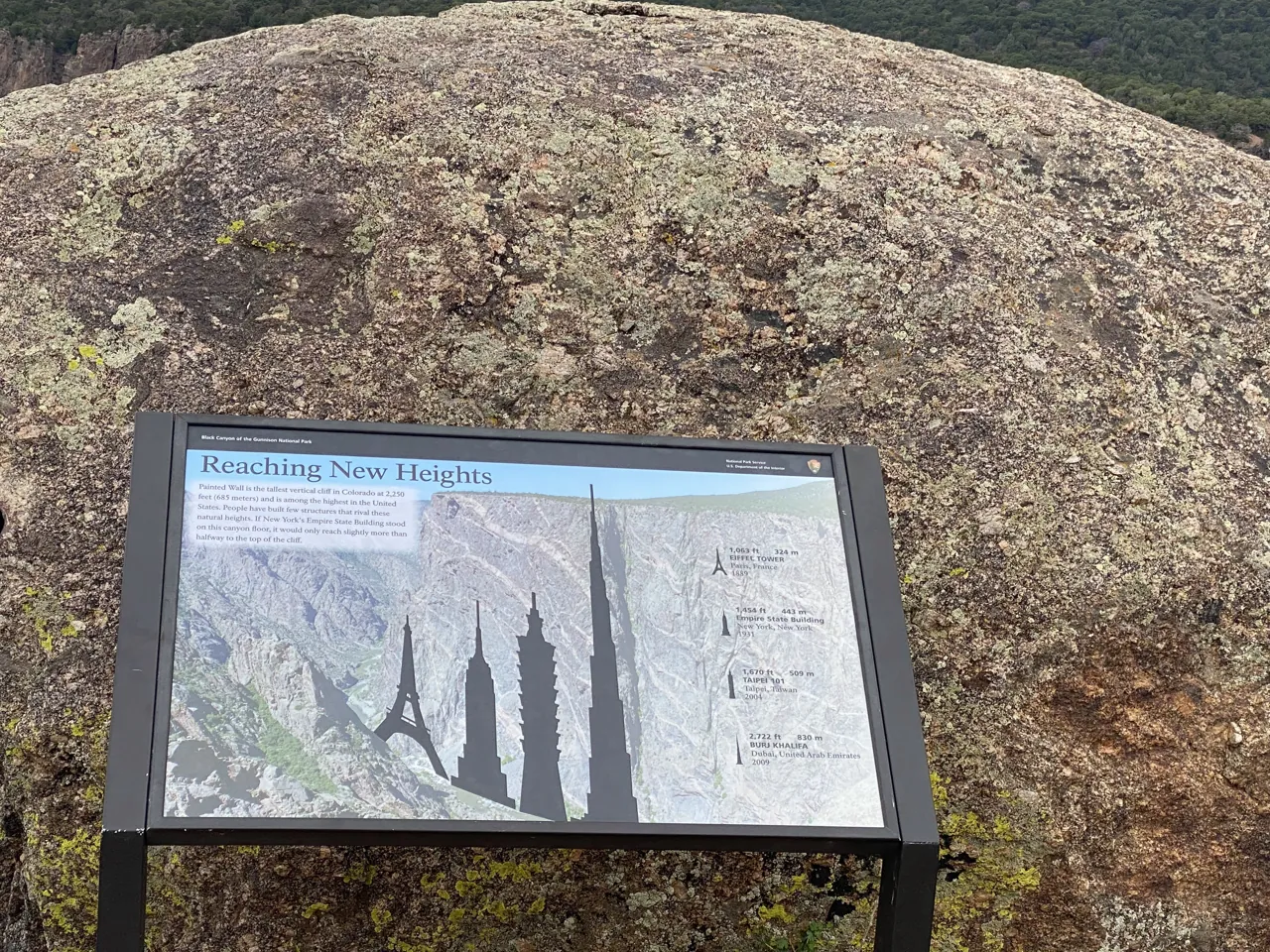
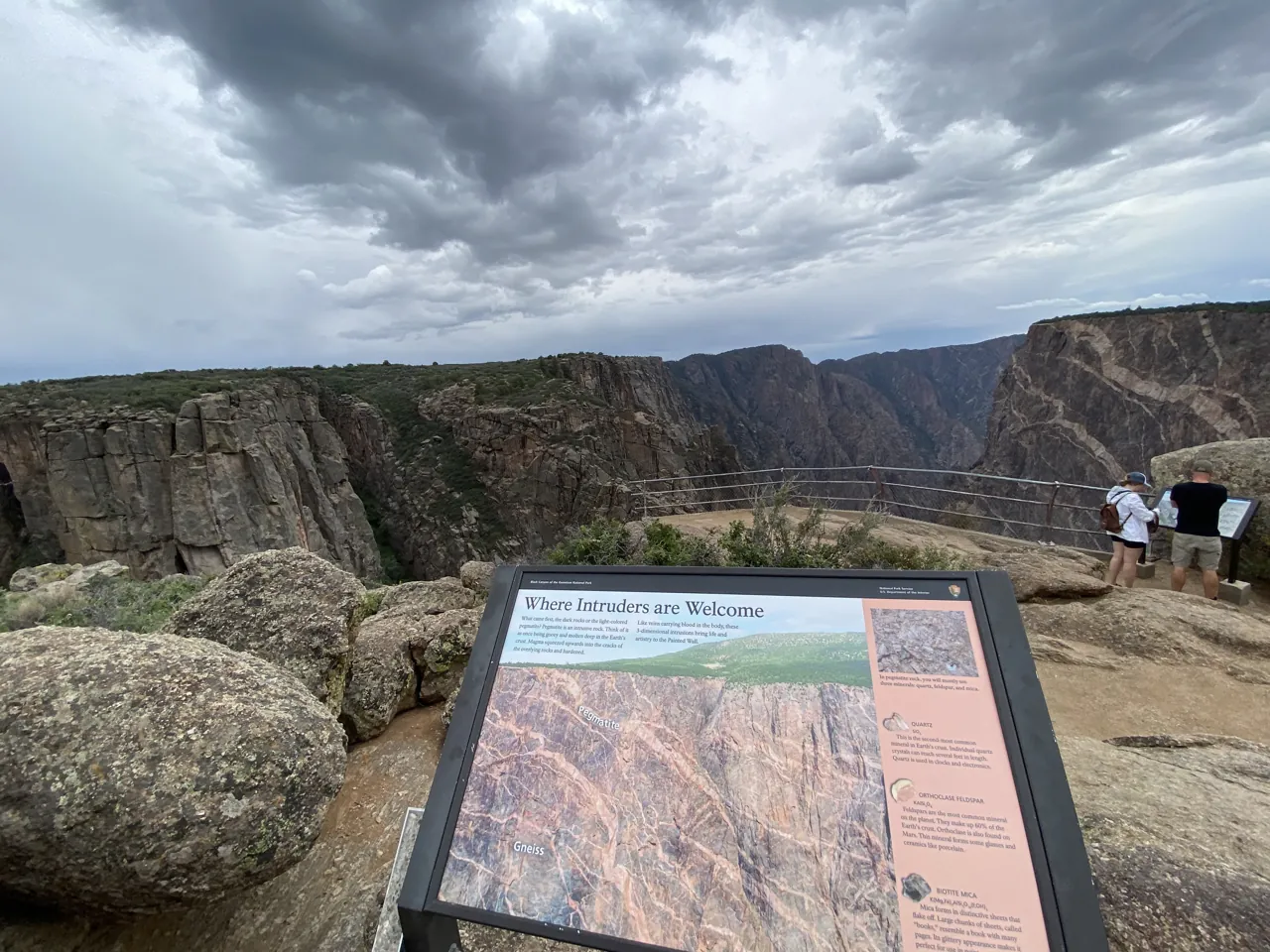
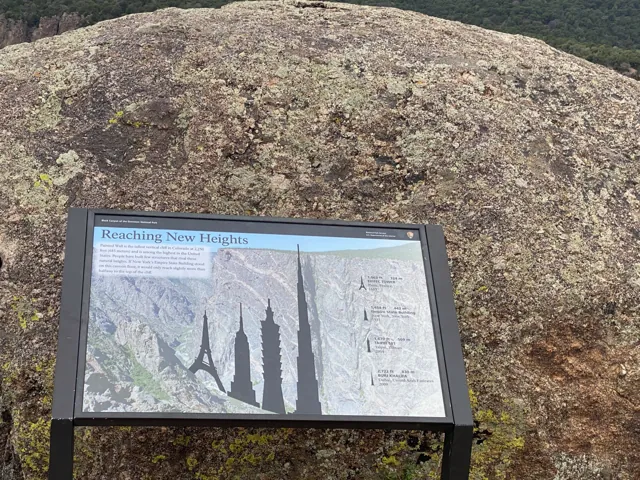
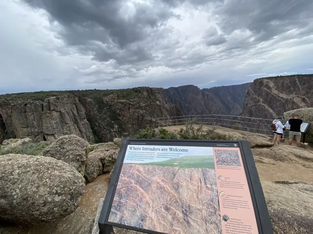
Read the signs at the Painted Wall overlook. One puts the height in perspective: stand the Empire State Building on the canyon floor and it would reach only a little more than halfway up. Another explains the stripes. They're pegmatite, molten rock that squeezed into cracks in the older, darker gneiss and hardened, mostly quartz, feldspar and mica. The sign calls them intruders, and they're what make the wall look painted.
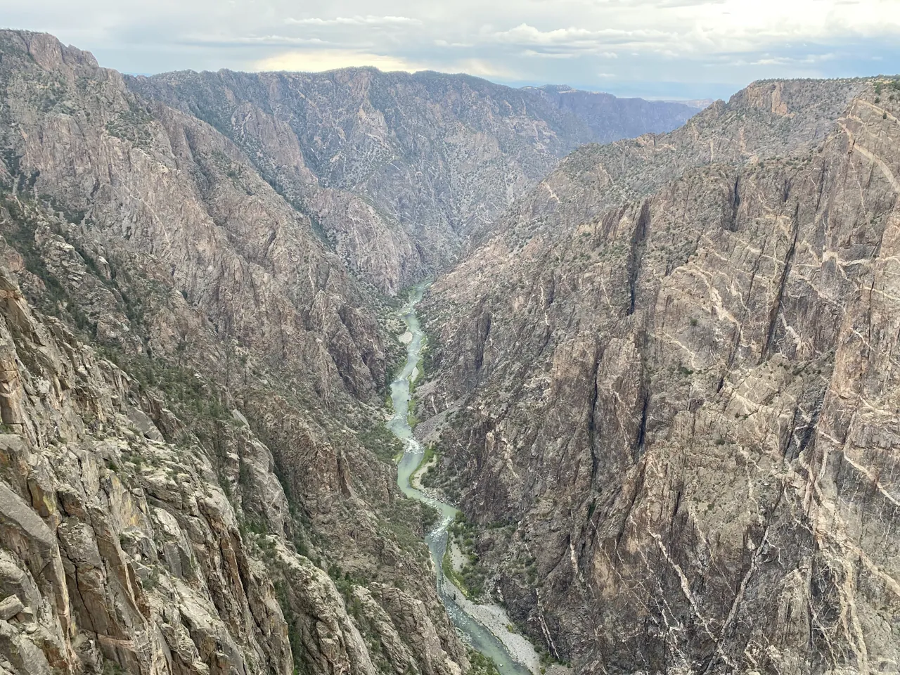
East Portal. A steep road drops from the rim to the river at East Portal. It has grades up to 16%, so use low gear. Vehicles over 22 feet, trailers included, aren't allowed, and the road is usually closed from November to April. At the bottom you're standing beside the Gunnison River, which is a completely different park from the one on the rim. East Portal sits at 6,547 feet, almost 2,000 feet below the rim. The road was built to haul crews and equipment for the Gunnison Tunnel, dug from 1905 to 1909 to carry river water to farms in the Uncompahgre Valley, and there are outdoor exhibits about it. A primitive trail follows the river upstream from the campground.
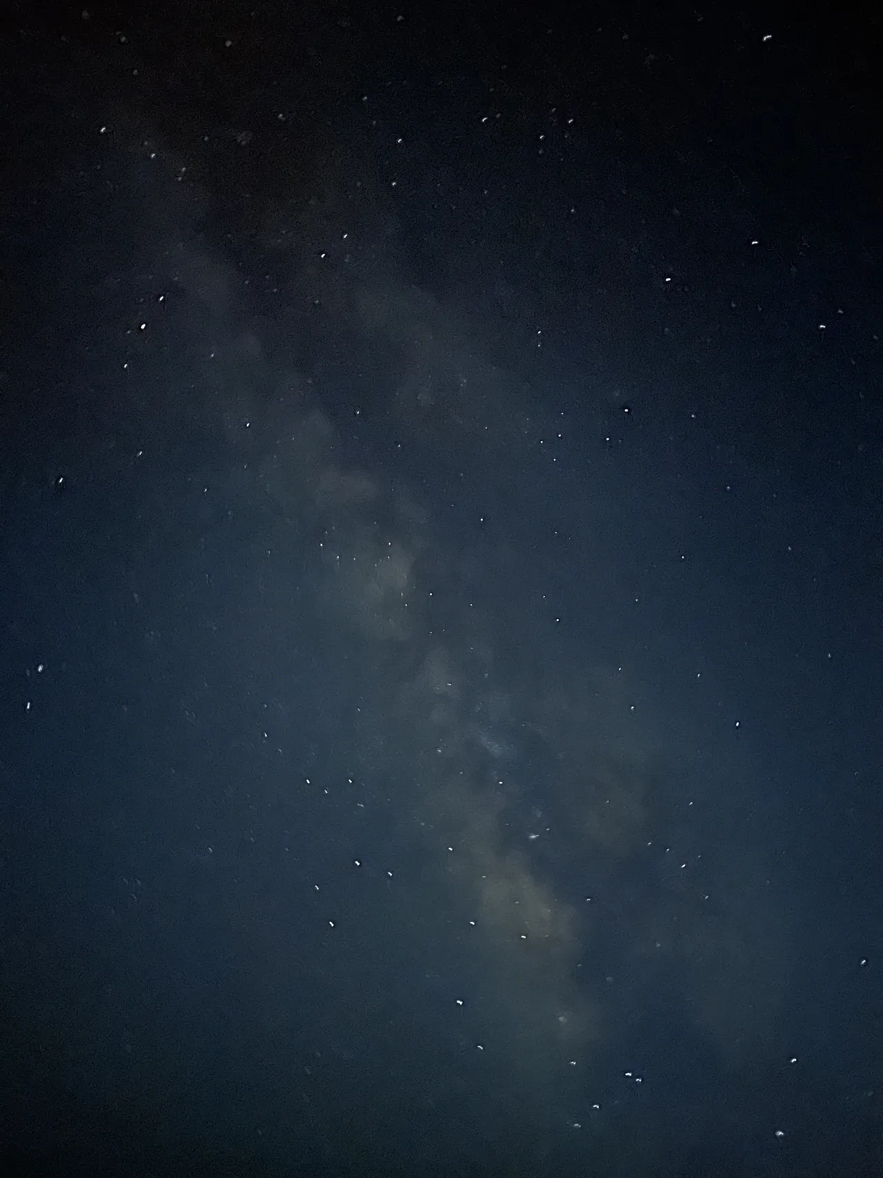
The night sky. Black Canyon has been a certified International Dark Sky Park since 2015. Pick one night, drive to any pullout, walk a short way from the car, and bring chairs and a hot tea. Lean back. You'll see the Milky Way and shooting stars, and you'll likely share the dark with local photographers who come for the same view. If you've never been surrounded by stars like that, it's worth the whole trip on its own. In summer, rangers and the Black Canyon Astronomical Society set up big telescopes on the South Rim, and the park holds an astronomy festival each year. Check the schedule online before you go.
The North Rim. It's about 11 miles south of Crawford via CO 92 and Black Canyon Road. Services are limited and the campground is small, so expect solitude and come self-sufficient. Walk the easy Chasm View Nature Trail through pinyon-juniper woodland for views of the Painted Wall, or take the longer Deadhorse or North Vista trails.
In winter. Snow closes most of the roads. South Rim Road is plowed only to Gunnison Point, and past there it becomes a cross-country ski and snowshoe route until it reopens in mid- to late April. East Portal Road closes to cars for the season, and North Rim roads close from about mid-November into May.
How the canyon was made
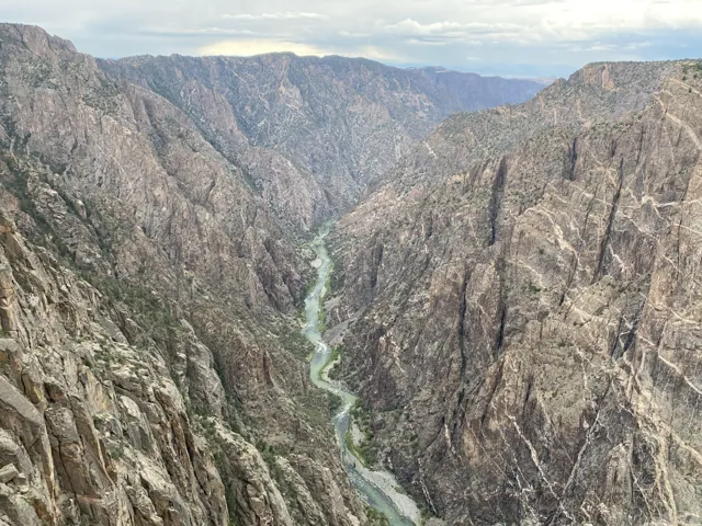
When the explorer John Gunnison scouted a Pacific railroad route in the 1850s, he judged Black Canyon impenetrable. What he couldn't see was how the river had done it. A geological event called the Gunnison Uplift raised a dome of extremely hard crystalline rock from deep in the earth. About two million years ago the Gunnison River began cutting through it, fed by spring snowmelt from the Elk, Sawatch, West Elk and San Juan mountains. The water drives huge boulders along the bottom, and they do the carving. The river still hasn't reached the bottom of that rock.
The dark rock in the walls is gneiss. The pink-white stripes are the pegmatite that squeezed in later.
How it became a park. Local residents rallied to protect the canyon, and it became a national monument in 1933, one of the last proclaimed by Herbert Hoover. Civilian Conservation Corps crews built many of its trails, roads and campgrounds. It became a national park in 1999.
What lives here
Mule deer, black bears, mountain lions and bobcats roam both rims. Bighorn sheep work the ledges of the inner canyon. Watch the air at the overlooks for peregrine falcons, white-throated swifts and violet-green swallows. At the river, American dippers share the water with beavers and river otters, and ringtails hide among the boulders at night. The sagebrush on the North Rim supports the Gunnison sage-grouse, a threatened species.
The plants change as you go down. Pinyon and juniper hold the rims, some of them centuries old. Gambel oak covers the slopes. Douglas-fir grows in the cool, shaded inner canyon, and aspens turn yellow in fall.
Hiking into the canyon
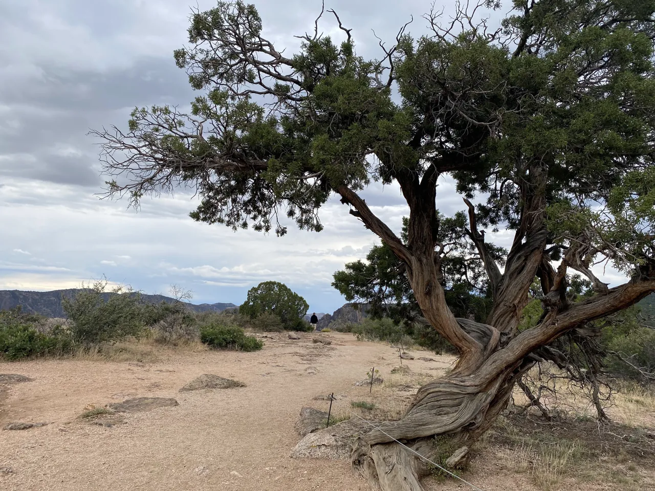
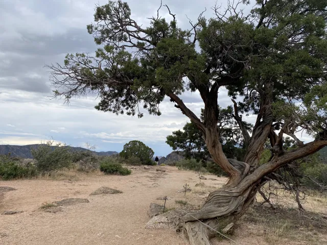
The rim has short trails with old, twisted junipers along the way: Rim Rock Trail (1 mile, moderate), Uplands Trail (2 miles, moderate), Oak Flat Loop (2 miles, rated difficult) and Warner Point at the end of the road. The real hiking here goes down, on unmaintained routes into the inner canyon. Take every one of them seriously.
The Gunnison Route is where most people start. It begins at the South Rim Visitor Center on the Oak Flat Trail, then drops about 1,800 feet in roughly 1.5 miles to the river. There's an 80-foot chain on a steep, loose stretch. Plan about 2 hours down and 2 to 3 back up. It has three riverside campsites.
The Warner Route is for experienced canyon hikers. It's the longest South Rim route: about 3.5 miles one way and 2,722 feet down from the Warner Point trail. Plan 2 to 3 hours down and 4 to 6 back up. It's steep and loose below the saddle, with poison ivy near the river, and five riverside campsites.
Permit: every hiker below the rim needs a wilderness use permit, and so do climbers and kayakers. They're limited; in summer you reserve them on Recreation.gov. To camp at the river, you book a riverside campsite with your permit.
Pack weight: everything you carry down, you carry back up, as much as 2,700 feet. Pack light, but don't skimp on water: the park says 4 quarts per person per day, or a filter for the river. Add sturdy boots, long pants, a headlamp, food for an extra day and a way to pack out your waste.
Weather: it can turn fast. I tried the Warner Route once and got turned away on arrival by a hailstorm. That's Colorado. Check the forecast, start early, and be ready to call it.
Critters and plants: watch for bears (keep your distance), porcupines and mule deer on the way down. At the bottom, look for beavers and rock squirrels, and watch out for poison ivy and ticks.
Climbing and rafting: climbing the walls is for experienced climbers only. Rafting is strongly discouraged inside the park. Rafters put in at the Chukar Trail, downstream in Gunnison Gorge National Conservation Area.
The Warner Route is still on my list, with a night camped on the canyon floor. When I've done it, the full story goes here.
If it's your first time camping
Arrive with daylight left. Pitching a tent you've never pitched, in the dark, is a rite of passage. It's also avoidable.
Test your gear at home. Set up the tent in the yard and light the stove once. I had to ask the campground host to help me get ours going. (Hosts are good people. Ask them.)
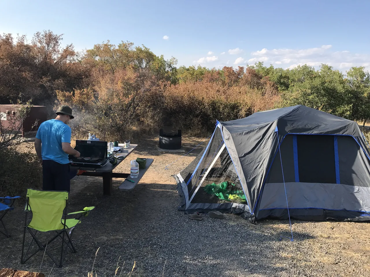
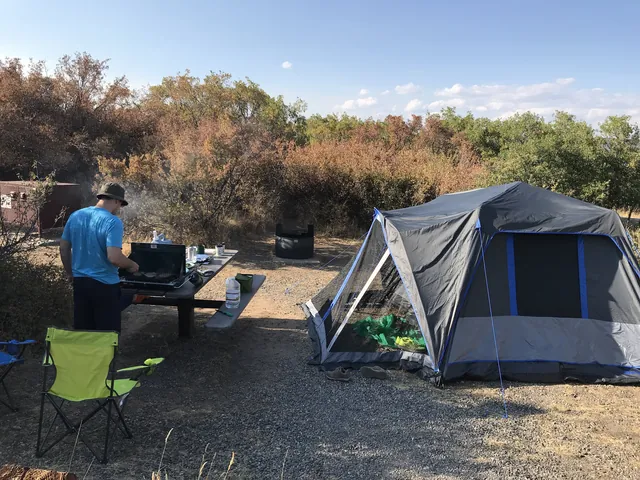
Our first campsite, August 2018. Bring a real sleeping pad or an air mattress. Sleep is what makes or breaks a first trip.
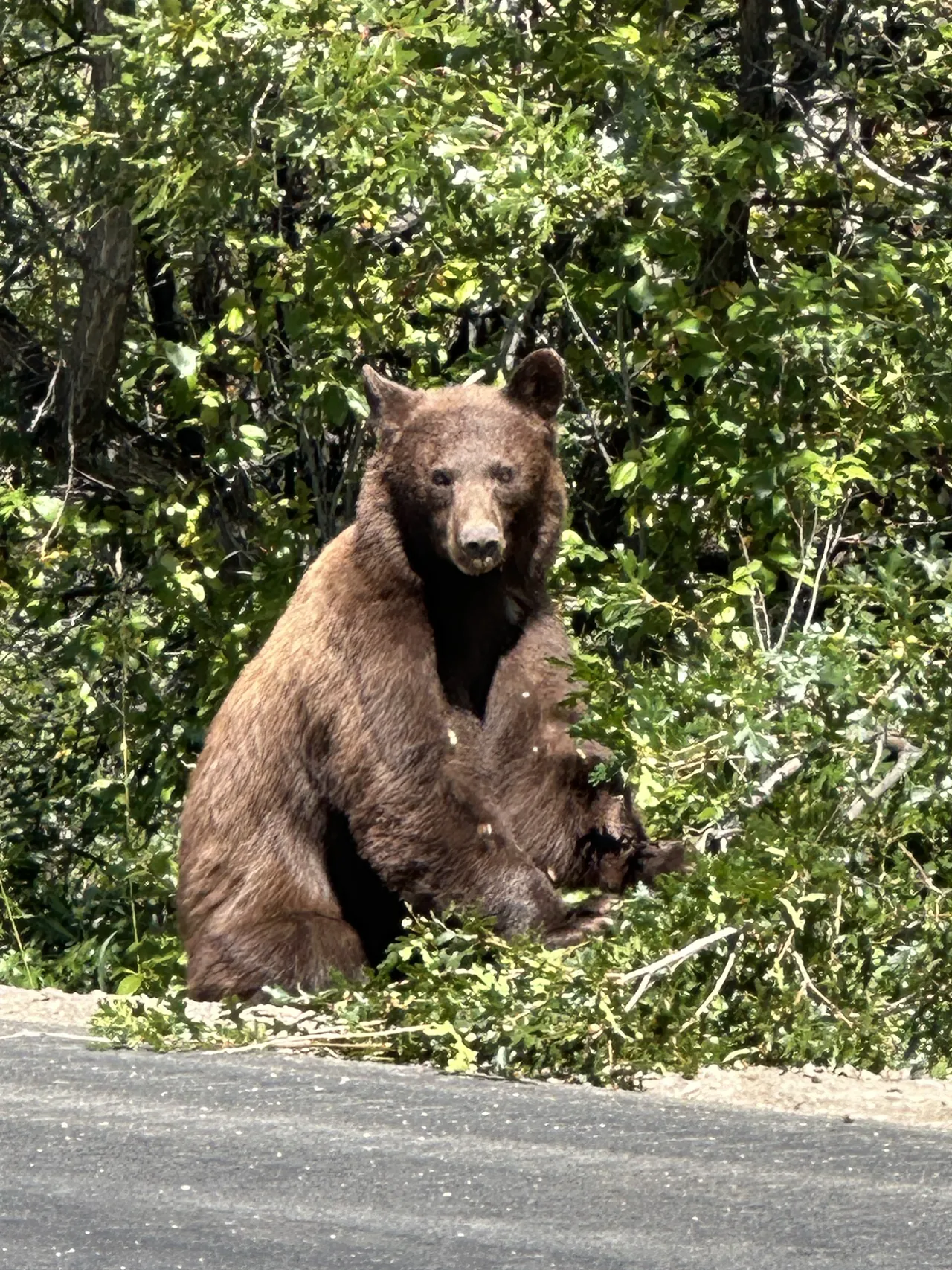
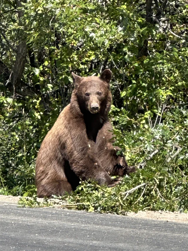
Night noises are usually deer. Bears are in the region, but in my experience they don't bother campers here. Store your food properly and you can sleep. They are up there, though: on a 2024 trip we saw a black bear by the road near the park entrance. If you see one, give it plenty of room.
If you fish
Bring your rod. This is where Black Canyon goes from a good park to a great one.
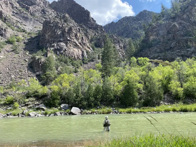
At East Portal, the road ends beside the Gunnison, with a small campground right on the river. (Check that East Portal Road is open first. See Check conditions above.) You can wade in steps from your tent, under walls most visitors only see from 2,000 feet up.
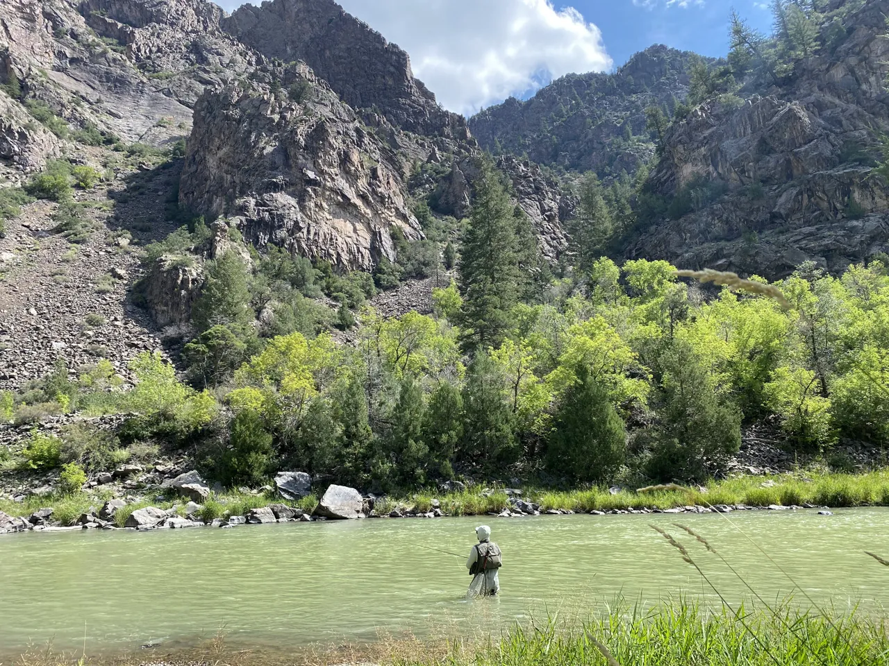
The Gunnison here is Colorado Gold Medal Water, and you'll need a Colorado fishing license. There are beautiful trout waiting in there. They aren't handed to you. Come prepared to wade, and expect some trial and error on bug choice: what works one morning can go quiet by afternoon, so carry a range of flies and change often until the fish tell you what they want. Walk the water and try different sections. On one trip I had a brutally slow morning in the deeper pools; what finally worked was moving into faster water with small black midge emerger imitations. Don't be afraid to target the faster water. When it clicks, it's some of the best fishing I know. Between fish, watch for American dippers diving into the current, great blue herons and eagles.
Black Canyon is also the only national park poster I know of with a trout on it, which is part of why it's dear to me.
(River details, flies and seasons live in my Gunnison River guide.)
Make it part of a longer trip
Black Canyon opened up a whole region for us: Montrose, Gunnison, Almont, Crested Butte, Lake City, Ouray and Telluride. If you're coming from the Front Range, give the park a day and a night, then keep going.
Questions?
Ask me anything about Black Canyon, camping there for the first time, or fishing East Portal. I answer every question.
Photos
Sources
- South Rim Campground (Recreation.gov)
- East Portal (NPS)
- South Rim Drive (Earth Trekkers)
- The Warner Route (Adventr)
- Inner Canyon Hiking (NPS, 2025)
- Black Canyon recognized for dark skies (CPR, 2015)
- Park Map, Black Canyon of the Gunnison (NPS Harpers Ferry Center, public domain)
- Black Canyon of the Gunnison National Park (NPS), incl. the official park brochure
- Current Conditions (NPS)
- Mudslides force closure of East Portal Road, campground and picnic area (NPS, July 2026)
- History and culture (NPS)
Pathlight
Park guides from the road. A printable trip sheet comes with them when one is ready.